Description
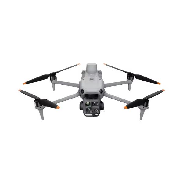
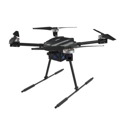
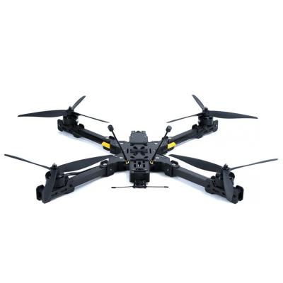
The professional drone, developed ZAi by , is a high - performance photography enthusiast flight platform designed for professional application scenarios.
1.Multi - function Integration: Integrates advanced flight control, high - precision sensing, and professional - level data acquisition functions. Equipped with [specific advanced sensors, e.g., high - resolution imaging sensor], [intelligent flight assistance system, e.g., AI - powered obstacle avoidance], it can efficiently respond to complex professional operation environments such as industrial inspection, mapping surveying, etc. |
2.Modular and Robust Design: Adopts modular design, integrating flight control module, high - precision positioning module (such as GNSS with GPS + Galileo + Beidou + GLONASS for precise positioning), and high - reliability communication module. The electronic equipment has excellent environmental adaptability, with [waterproof, dust - proof level, e.g., IP67 - level protection], ensuring stable operation in harsh environments like strong wind, dust, and light rain. |
3.Diverse Operation Modes: Equipped with multiple operation modes such as autonomous mission flight, waypoint flight, and terrain following flight. It is suitable for rich professional scenarios including industrial facility inspection, topographic mapping, and emergency rescue scene investigation. |
4.Outstanding Safety and Performance: [Advanced safety - related components, e.g., High - precision obstacle detection radar] can quickly detect obstacles such as buildings and power lines. Matched with [supplementary safety devices, e.g., high - brightness warning lights], making operation in complex environments safer; the body is made of [high - strength material, e.g., carbon fiber composite material], which is lightweight and durable, and the folding structure (if applicable) has a reliable locking mechanism to ensure flight safety. |
5.Efficient Data Processing: Lightweight and foldable design (if applicable), easy to carry and transport. Combined with a professional data platform, it can achieve global visualization and analysis of operation data, supporting real - time transmission and post - processing of high - definition image and point cloud data, enhancing the level of intelligent operation in professional fields. |
|
Who we're currently dealing with?
Law Enforcement: Automatically identify and target tracking, conduct reconnaissance intelligence collection, disaster response, as well as pre planning and situational response Fire rescue: identify fire lines, maintain fire belts, buildings, public utilities and infrastructure, content and media, etc
Technical Parameters
Drone Parameters | |
Model Number | ZAi-4T | Number of channels | 2 channels |
Product Name | ZAi-4TProfessional commercial drones | Controller mode | Right throttle |
Remote distance | 20 | Material | Carbon fiber |
Remote control battery | lithium battery | Does it support special aerial photography? | yes |
Features | APP remote control, automatic return |
GPS, Integrated camera, obstacle avoidance |
Motor | Brushless motor | Product voltage | 4s |
Origin |
China |
Battery | Remote Control |
Aircraft battery | 8070mAh | Remote control battery | lithium battery |
| | Operation level | Beginner |
drone Parameters |
Dimensions | 7 inches or more |
Specification | Foldable |
Power supply:Electric |
Media | Micro SD card |
Video shooting resolution | Ultra high definition 8K |
Camera gimbal type | Three pull gimbal |
Suitable for indoor/outdoor use | outdoors |
Unmanned aerial vehicle type | commercial unmanned aerial vehicle |
Thermal imager :640 * 512@25FPS |
laser range finder | 5-1200m |
Visual sensing system:0.5-31 meters |
Millimeter wave radar sensing system | 0.3-20 meters |
The set includes: original packaging box, battery, operating instructions, charging, remote control, camera |
Product Application
- Beneficiary group: Law enforcement officers (police, law enforcement agencies).
- Applications: Aerial surveillance for criminal tracking, crime scene investigation (evidence collection, scene mapping), search - and - rescue operations (locating missing persons in complex terrains), and large - scale event security monitoring (parades, sports events).
- Advantages: Equipped with high - resolution 8K cameras and thermal imaging, enabling clear image capture day and night. Long - range control (remote distance of 20) and multiple GNSS systems (GPS + GLONASS + Galileo + Beidou) ensure stable flight and accurate positioning in various environments. Obstacle avoidance features (visual and millimeter - wave radar sensing systems) enhance safety during flight in complex urban or rural law enforcement scenarios.
- Case: In a mountainous area of [Region], when searching for a missing hiker, traditional ground search took hours with limited results. Using the Autel Robotics EVO Max 4T drone, the thermal imaging and high - resolution camera quickly located the hiker in rugged terrain within 30 minutes, enabling timely rescue.
- Beneficiary group: Firefighters and emergency rescue teams.
- Applications: Fire source detection (locating ignition points in large fire scenes), fire spread monitoring (tracking how fires spread across forests or urban areas), and post - fire damage assessment (evaluating building and terrain damage). Can also be used for search - and - rescue in fire - affected areas to find survivors.
- Advantages: High - precision thermal imaging (640×512 @ 25FPS) can detect small heat sources through smoke. Long flight endurance (10 - 20 minutes, depending on model) and high maximum altitude (6000 meters) allow it to cover large fire - affected areas. The ability to operate in low - light conditions (suitable for night - time fire rescue) and resist harsh environments (built - in robust systems) make it reliable.
- Case: During a forest fire in [Forest Area], the drone was deployed to monitor the fire spread. Its thermal imaging identified hidden fire sources behind smoke, and real - time transmission of fire perimeter data helped firefighters plan containment lines. Compared to manual ground reconnaissance that was slow and dangerous, the drone completed the assessment in 1 hour, reducing response time and potential risks.
-
- Beneficiary group: Utility companies (power, water, gas), infrastructure management departments.
- Applications: Power line inspection (checking for damage, sagging, or foreign objects), pipeline inspection (detecting leaks in oil, gas, or water pipelines), and tower inspection (telecom towers, wind turbine towers for structural damage).
- Advantages: High - resolution imaging (8000×6000 maximum photo size) and zoom capabilities (e.g., 112× zoom as shown in related product features) allow detailed inspection of small components on infrastructure. Long - range operation (remote distance of 20) and stable flight in various weather conditions (with IP - rated protection, though specific not fully clear from params but implied by professional design) enable inspection of hard - to - reach or remote infrastructure.
- Case: A power company used the drone to inspect a 50 - kilometer high - voltage power line in mountainous terrain. Manual inspection would have taken days and been risky. The drone, with its high - resolution camera and zoom, detected 3 damaged insulators in 2 hours, allowing timely repairs and preventing potential power outages.
Scene 4: Logistics
- Beneficiary group: Construction companies, mining enterprises.
- Applications: Construction site surveying (mapping terrain, monitoring construction progress), mining site monitoring (tracking ore extraction, monitoring for safety hazards like slope instability), and volume measurement (calculating stockpile volumes of construction materials or mined ore).
- Advantages: Accurate GNSS positioning (GPS + GLONASS + Galileo + Beidou) ensures precise mapping and surveying. High - resolution imaging and thermal sensing can detect early signs of structural issues in construction or mining sites. The ability to carry out autonomous flight missions (waypoint flight, etc.) allows for regular and systematic monitoring of large sites.
- Case: At a large - scale construction site for a new highway, the drone was used to survey the terrain before construction. Its high - precision mapping replaced traditional manual surveying that was time - consuming. During construction, regular progress monitoring via the drone identified delays in a certain section 3 days earlier than manual checks, enabling timely schedule adjustments. In a mining operation, it accurately measured ore stockpiles, reducing measurement errors by 15% compared to manual methods and optimizing inventory management.
你是如何想到这些关键词的?
你能帮我把这些关键词翻译成中文吗?